Real-time ocean intelligence for every mission
Deployed in minutes, anywhere you operate. Real time ocean data, route optimization, and maritime domain awareness at the speed of decisions
From sensor to decision
Sofar builds sensors to collect ocean data, and the solutions that turn that data into decisions. Deploy on demand while also tapping into a pre-existing global ocean data network. Layer in software solutions to turn your real-time data into mission planning support, detection and classification of subsurface activity, and route optimization.

Spotter Buoy
The rapidly deployable marine sensing buoy, transmitting real-time surface and subsurface observations from the moment it deploys.

A-Size
An autonomous profiling float, designed to dive beneath the surface and collect vertical profiles of subsurface ocean conditions.

Scout by Online Oceans
A solar-powered uncrewed surface vehicle that carries Spotter sensing where moorings are not practical, holding station or transiting as the mission demands.
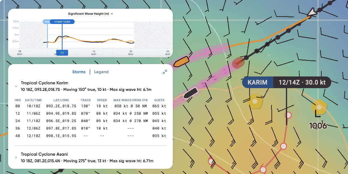
Wayfinder
Voyage intelligence that optimizes route, speed, and schedule for mission success, powered by live ocean observations.
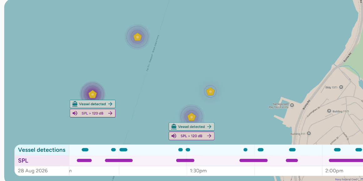
Sentrix
Networks of Sofar sensors that detect, classify, and alert on activity above and below the surface. Built for counter-UUV, port and harbor security, and critical infrastructure protection.
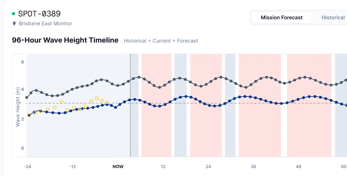
Spotcast
Hyperlocal marine weather forecasts and GO/NO GO decision support, sharpened by real-time observations from the Spotter network.

Global weather
Global ocean conditions and AI-informed forecasts, grounded in real-time observations from the Spotter network.
Built for operations above + below the surface
Real-time ocean data delivers ground truth to support any mission.
Operational Planning
Real-time, predicted sea states to plan for mission success.
Real-time and predicted waves, winds, and currents for GO/NO GO decisionmaking.
MDA and Port Security
Real-time, predicted sea states to plan for mission success.
Passive acoustic monitoring for continuous port and harbor awareness detects surface vessels and underwater vehicles without gaps in coverage.
Contested Logistics
Optimized routing to sustain deployed forces at sea.
Optimized routing to sustain globally distributed supply chains.
METOC Support
Operator-trusted ocean observations and forecasts.
Validated wave, weather, and subsurface observations from our global network accessible via dashboard or API for forecast modeling.
Spotters deployed globally
01 / 04
Real-time observations per day
02 / 04
Vessels routed
03 / 04
More accurate forecasts
04 / 04
The data you need for a confident go or no-go.
Rapid deployment
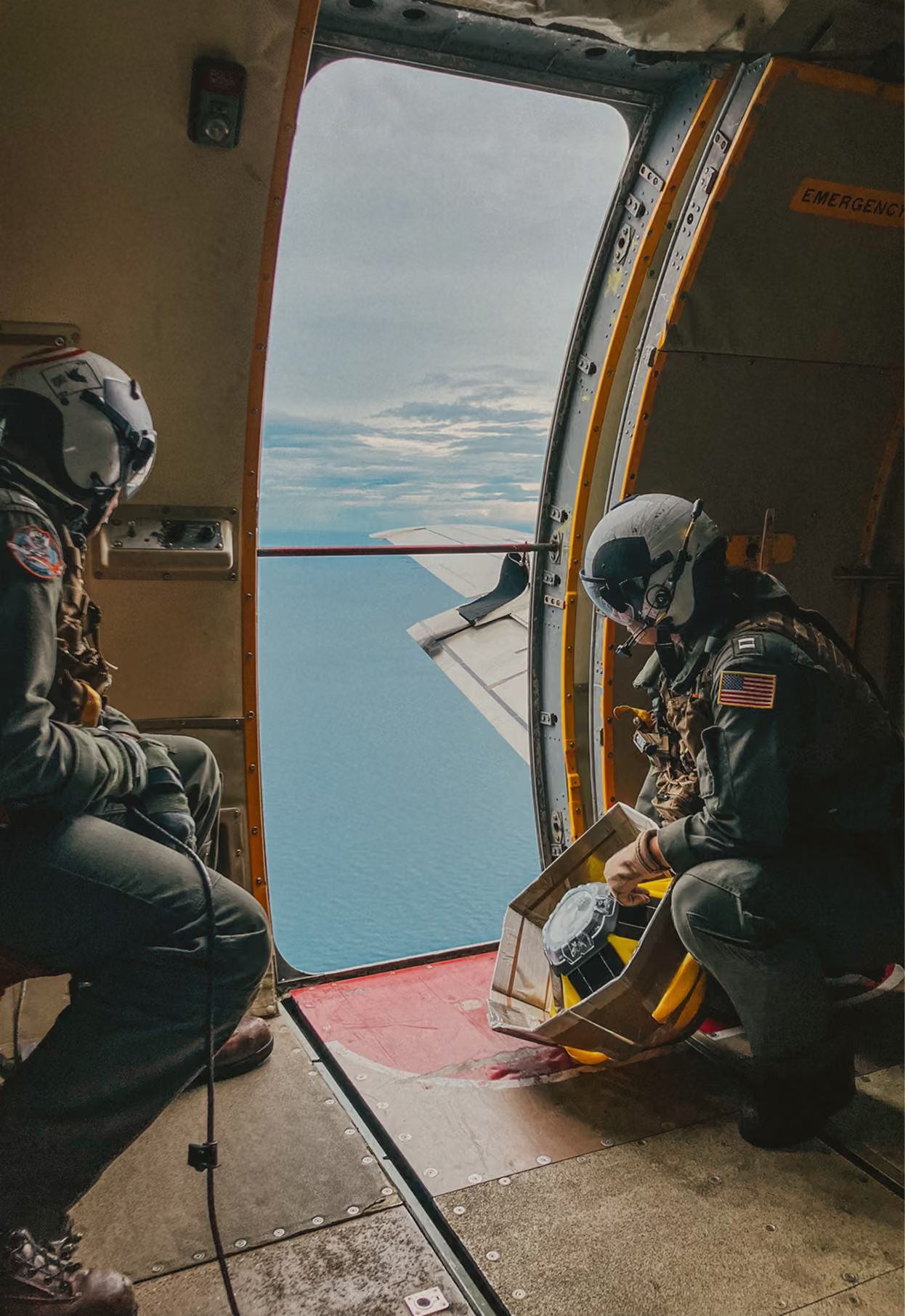
Deployable by air, small vessel, or ship, and operational within minutes of hitting the water, so you get data exactly where you need it.
Persistence
Solar-powered platforms report continuously for months without maintenance.
Surface and subsurface
Waves, wind, pressure, and temperature at the surface; acoustics, currents, and water column profiles below it.
Around-the-clock detection
Passive acoustic sensing runs day and night, with alerts pushed to the tools your operators already use.
Forecast accuracy
Real-time observations assimilated into our models cut forecast error where it matters most: at sea.
Interoperability
Data delivered through ATAK, the Spotter Dashboard, and the Ocean Data API.